
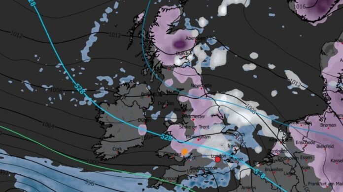

New snow maps for the UK have captured a cold front moving swiftly towards the country, expected to bring snow over a vast area, with one region facing rare freezing rain.
Recent days have seen a mild turn in the forecast, with temperatures remaining in the low single digits as winter 2025/26 nears its end. The slightly warmer weather has led to more chaotic conditions, including heavy wind and rain affecting most parts of the country since last week.
Weather predictions indicate that the weather will continue to be tumultuous in the early days of February 2026, with the possibility of rare occurrences such as freezing rain as temperatures drop below zero.
Latest maps from WXCharts show an Arctic system arriving just before Valentine’s Day on February 13, likely bringing snow across a 601-mile stretch from north to south, covering the entire length of the country. While the snow is expected to accumulate up to a couple of centimeters, the conditions may lead to more severe freezing rain in a smaller area.
Freezing rain is forecast to occur over southern Wales, specifically near Newport and Cardiff, affecting areas like Carphilly, Cwmbran, Pontypool, Merthur Tydfil, and Ebbw Vale, as temperatures drop to -4°C. Unlike the snow, the freezing rain is anticipated to be brief, ending by 6pm and delivering around 0.1mm per hour. The rain is expected to transition to normal rain upon reaching Bristol on the same day.
The snow is projected to persist across the country for the next few days, potentially lasting until at least February 15. The Met Office’s long-range forecast for the period between February 6 and 15 warns of upcoming rain and colder conditions.
The forecast indicates, “Frontal systems from the Atlantic, guided by a southward jet stream, are likely to approach the UK, but could stall due to a high-pressure area to the north and northeast, resulting in further rain in flood-prone regions.
“As these rain bands move northward, some snow may occur in northern England and Scotland, particularly in elevated areas, as they encounter colder temperatures.”
“A slight southward shift of low-pressure areas is expected in the second week of February, possibly allowing colder air to spread across more parts of the UK, increasing the risk of wintry conditions for a period.”
Prior to this, wintry hazards are expected in the UK, with the Met Office issuing yellow weather warnings for ice and rain until February 2 and 3 in the southwest, posing risks of fog and slippery surfaces.